Alerts issued ahead of back-to-back weather events
Lee O'Connor
04 October 2022, 2:40 AM
 Authorities have issued alerts for inland NSW ahead of two 'significant' weather event this week.
Both the State Emergency Service (SES) and the Bureau of Meteorology (BOM) have issued alerts ahead of two significant rain events expected to impact a widespread area this week urging communities and travellers across the west to "stay on top of the warnings'.
This morning the NSW SES Commissioner Carlene York was joined by BOM Meteorologist, Gabrielle Woodhouse to provide an operational update on the coming weather.
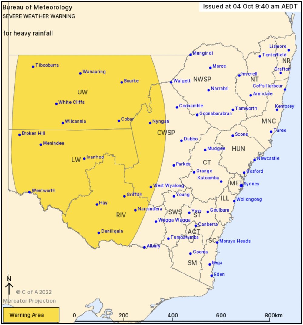
A severe weather warning is already in place for a number of regions as the first front is forecast to bring moderate to heavy rainfall to inland areas today and tomorrow.
"A second system is expected to follow very quickly and bring widespread rain to inland parts of NSW again, particularly around the Western Slopes and Plains from Friday," said Ms Woodhouse.
"We're looking at around a month's worth of rain, particularly in inland areas."

"What this means is that we'll start to see more of a flash flooding risk as well as a riverine flood risk over coming days," she said. "We urge everyone to stay on top of the warnings, even in areas away from river systems that have been in flood for some time."
The NSW SES has already had one of their busiest years ever, with more than 60,000 requests for assistance so far, including more than 2200 in September and more than 100 flood rescues.
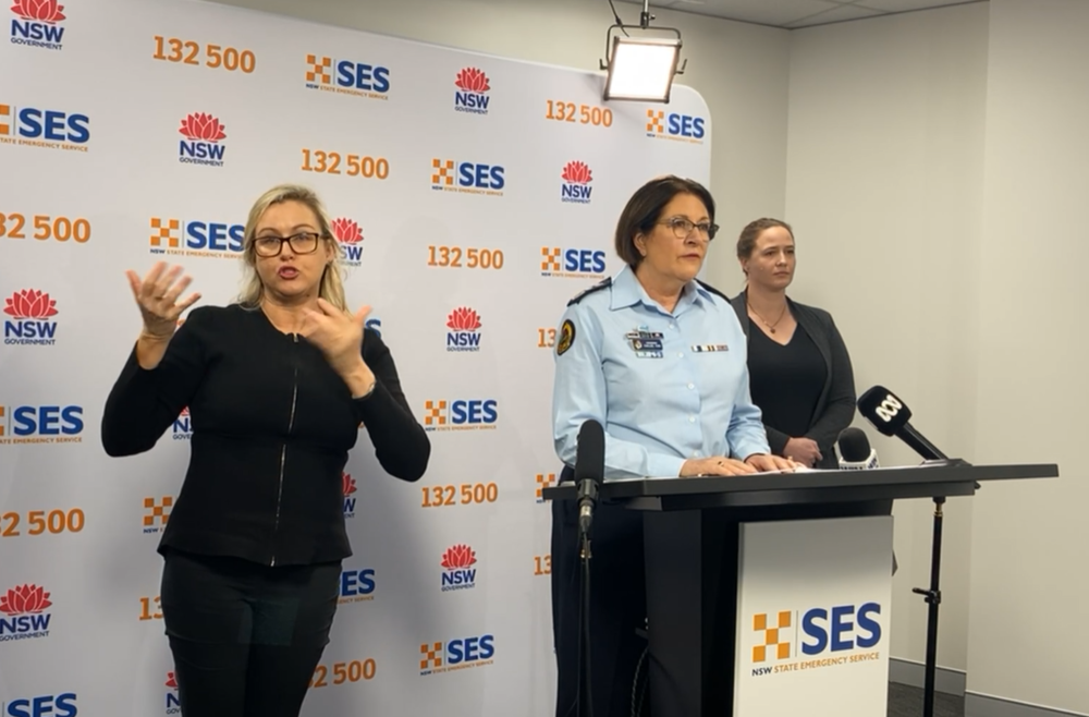
A translator with the SES Commissioner Carlene York and BOM Meteorologist Gabrielle Woodhouse at this morning's press conference.
Commissioner York reinforced the gravity of the situation expected to arise from the coming weather.
"We know the ground is saturated, dams and full and rivers are in various stages of flooding across the state," she said.
"My message to the community is if you see water across a road, turn around and make another route."
"You can't see what's under the water and often it is fast flowing and can easily lift and move a car and put your and other people in the car at risk."
"We are particularly concentrating on western and central NSW," she said.
Towns such as Wee Waa, Warren and Gunnedah are already on alert.
"We are also keeping an eye on Nyngan," Commissioner York said. "The majority of rivers have been very close to full and this added rain will increase the risk in those areas."
She said the SES have already deployed additional vehicles, boats and aerial assets across areas at risk.
The main rivers of concern at this stage are the Namoi, Darling, Culgoa, Bogan and Barwon.
The heavy rainfall risk will mainly be with thunderstorms embedded in the rain band, with Bourke and Cobar included in the areas identified at risk.
Six-hourly rainfall totals of 20-30mm are likely, with localised falls up to 60mm possible. 24-hour rainfall totals of 40-60mm are likely, with localised falls up to 80mm possible.
"Anyone driving around those areas needs to take extra care," she said. "It is important to have a battery operated radio in case you cant get access to messages electronically or through television."
"Every flood is different so people shouldn't assume that if they haven't been affected in the past they won't be affected in future."
Residents have been reminded to clean their gutters and have a plan for the safety of themselves and any animals, including moving livestock to higher ground.
"We will have a lot more messages in coming days so please heed the warnings," said Commissioner York.
View the full video
Communities should stay up to date with the latest forecasts and warnings via the Bureau's website and the BOM Weather app and follow advice of emergency services.
For assistance call the SES on 132 500 or in emergencies call 000.


