Another quake shakes western plains

Kristin Murdock
17 September 2025, 7:50 AM
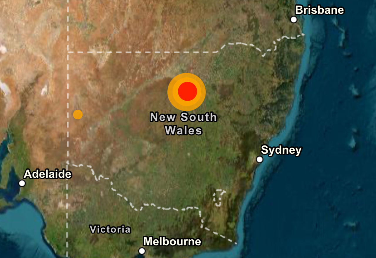
New South Wales has experienced a flurry of seismic activity over the past two days, with three earthquakes detected from the western plains to the Hunter Valley and the Mid North Coast.
According to Geoscience Australia, the first tremor struck on Monday 15 September, in the Marra Creek area, southwest of Carinda.
Coincidentally, the same area experienced a sizeable 5.2 magnitude quake in May this year, followed by a series of diminishing aftershocks.
Monday's magnitude 3.8 earthquake occurred at 1:05pm AEST and was “well located and well constrained,” Senior Seismologist Hugh Glanville said, giving experts a solid estimate of its location, depth and size.
The quake attracted only seven "felt reports" from residents, reflecting its remote setting.
The quake was estimated to be at a depth of 25 kilometres.
“It was a magnitude 3.8 and it’s reasonably sparsely populated just around there, so we only had seven felt reports,” Mr Glanville said.
Geoscience Australia encourages people to log their earthquake experiences on its website, as community reports help seismologists understand how far shaking travels and how intense it was in different areas.
“We do use them to determine the size of the earthquake, where it is, and how strongly the shaking travels,” Mr Glanville said.
The agency also issued a reminder to residents.
“If you feel an earthquake, drop, cover and hold on to keep yourself safe, then submit a felt report to our earthquakes.ga.gov.au website.
"This data is extremely valuable to help us better understand the intensity of earthquakes in Australia and informs important decision-making tools like the National Seismic Hazard Assessment.”
Two more tremors followed across NSW between late Monday night and Tuesday morning.
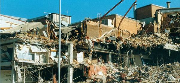
The Newcastle earthquake in December 1989 claimed 13 lives and measured 5.6 on the Richter scale.
A shallow magnitude 3.7 quake struck near Muswellbrook in the Hunter Valley at 4:20pm Tuesday, centred at the Mount Arthur Coal Mine and at an estimated depth of 10 kilometres.
A third quake, measuring magnitude 3.1 and just 5 kilometres deep, occurred near Bulahdelah at 7:50am Tuesday and was felt from Nelson Bay to Forster and inland to Maitland, with Geoscience receiving about 100 reports.
The earthquakes have prompted questions about whether mining activity can trigger seismic events.
Mr Glanville said the link is difficult to pin down.
“It’s possible for mining to influence seismicity, but we can’t confidently say that it’s associated with or not associated with the mining,” he said.
“Sometimes it’s really clear when there’s blasting or collapses, but often mining is along fault-controlled mineralisation.
"If the stress is pushing on the fault in the right direction to release that stress, it can then host those earthquakes.”
While three earthquakes in quick succession may seem extraordinary, Mr Glanville said the burst of activity is “a bit unusual, but not unheard of.”
He explained that aftershocks or earthquake swarms sometimes occur, leading to sporadic activity.
The Hunter Valley is one of the state’s higher-risk regions, having previously experienced the devastating Newcastle earthquake in 1989.
Western NSW, by contrast, is usually considered a quieter seismic zone.
“Western New South Wales is quite quiet, for want of a better term, in terms of earthquakes.
"There’s a lower chance of having strong shaking out there,” he said.
Each earthquake is added to a national catalogue that informs seismic hazard maps and building codes, helping engineers design structures to withstand shaking in more earthquake-prone regions.
For residents of western NSW, the Girilambone quake was more curiosity than catastrophe, but it added to a burst of seismic activity reminding Australians that even in quieter regions, the ground can still move.