BOM declares back-to-back La Niña event

Laura Williams
24 November 2021, 7:50 AM
 BOM have been monitoring for a possible La Niña event since September this year.
 While locals across the Western Plains have made their peace with sizzling summer days, yesterday’s declaration of a La Niña that has developed across the Pacific Ocean means the outlook of the coming months could shift.
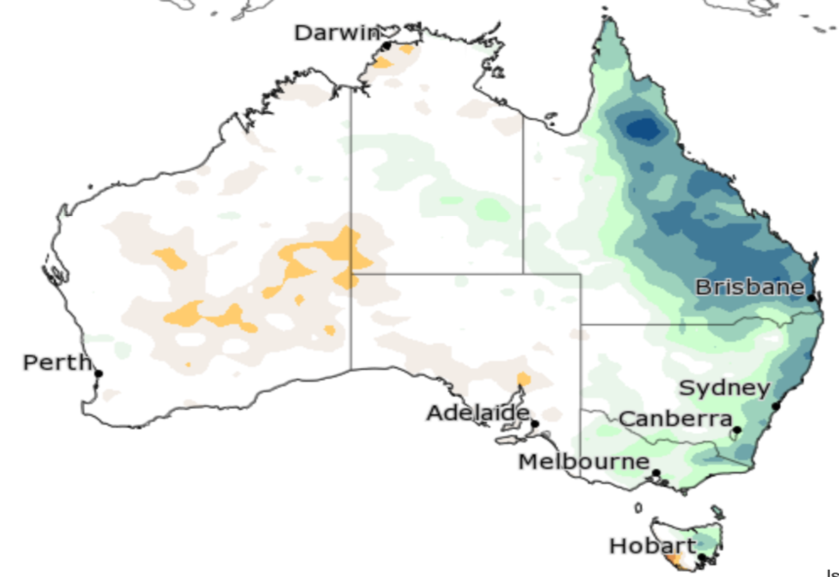
The Bureau of Meteorology (BOM) announced yesterday afternoon that a La Niña has developed, where typically rainfall becomes focused in the western tropical Pacific, leading to a wetter than normal period for eastern, northern, and central parts of Australia.
A La Niña is part of a cycle known as the El Niño-Southern Oscillation (ENSO), where shifts in ocean temperatures and weather patterns along the equator in the Pacific Ocean naturally occur.
As areas around the Western Plains remain flooded, SES Western Zone Officer David Rankine said that the rains aren’t likely to let up in the coming months.
“The nature of the La Niña system at the moment is bringing regular fronts where we can expect regular flooding events right across NSW between now and March,” Mr Rankine said.
He predicted from that regardless of future weather events, the rainfall over the last week will likely see waters continue to run through the Western Plains as it makes its way from Eastern communities to bodies of water further West into the Menindee Lakes.
“Communities like Brewarrina will see flooding around Christmas and into the new year. It’ll be a long year from that perspective,” Mr Rankine said.
While La Niña events aren’t often come by, it was only last year that one occurred during the spring and summer of 2020-21, where locals will remember an uncharacteristically cooler season.
The Bureau’s Head of Operational Climate Services Dr Andrew Watkins said that the chances of cooler average daytime temperatures in increased for large parts of Australia, but so too are the chances of tropical cyclones.
“La Niña is also associated with earlier first rains of the northern wet season, as we’ve observed across much of tropical Australia this year,” Dr Watkins said.
The La Niña, while a sign of more rain and cooler periods, isn’t predicted to be a dramatic event this year, particularly across the Western Plains.
According to BOM, local communities have a 40-65 per cent chance of exceeding median rainfall for the area in the coming two months.
“The last significant La Niña was 2010-12. This strong event saw large impacts across Australia, including Australia’s wettest two-year period on record, and widespread flooding,” Dr Watkins said.
Dr Watkins said that this year’s event is not predicted to be as strong as the 2012-12 event and may even be weaker than in 2020-21.
The Bureau previously shifted to La Niña WATCH on 14 September 2021, and to La Niña ALERT on 12 October 2021. La Niña is likely to persist until at least the end of January 2022.