Heavy rain starts off weekend

Lily Plass
28 March 2025, 1:40 AM
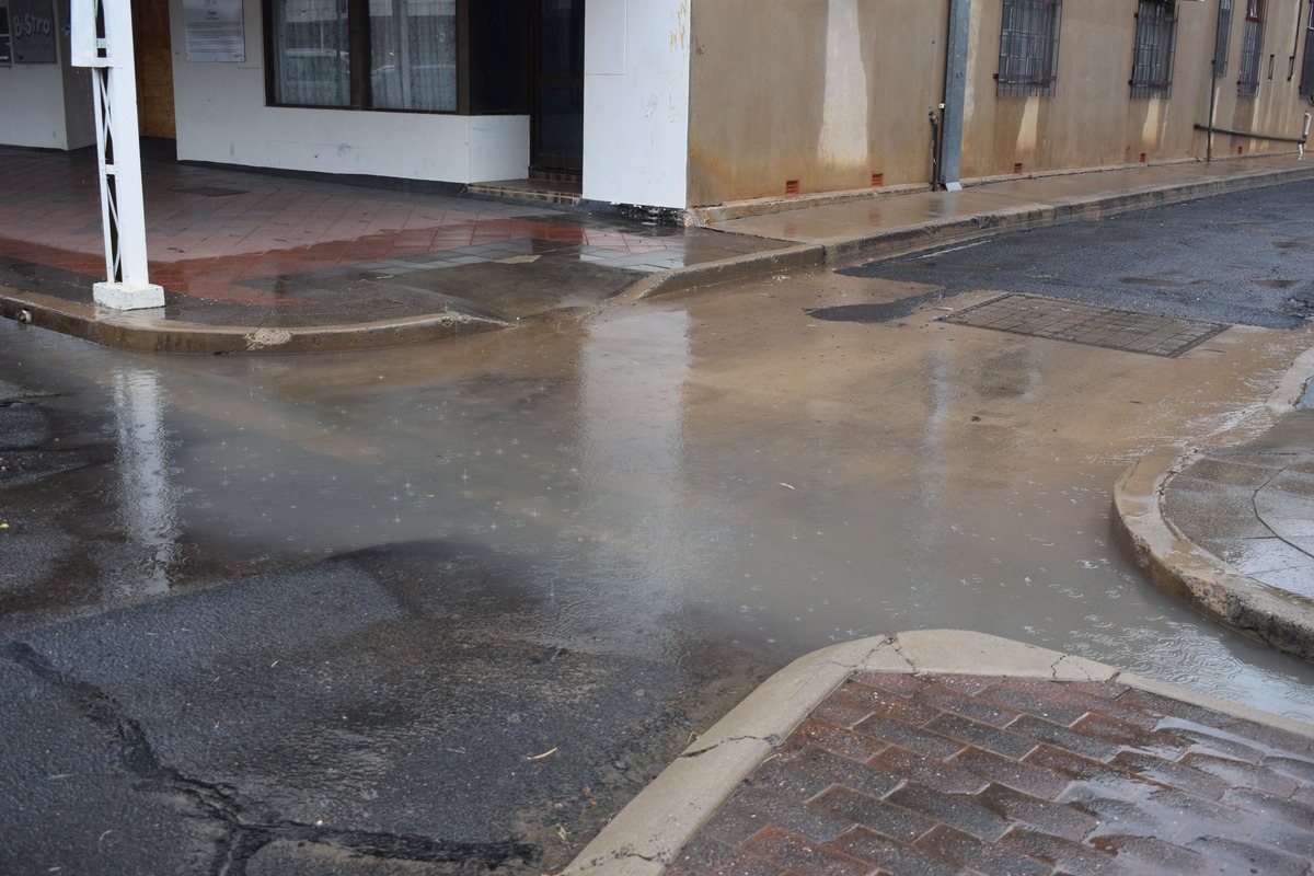 Rain in the Coonamble main street
Heavy rainfall from inland Queensland is making its way down south.
Six-hour rainfall totals are expected between 30 to 50 millimetres (mm) with isolated falls of up to 80 mm.
Twenty-four rainfalls are expected between 50 to 100 mm with isolated totals of 130 mm.
At 12pm several towns already recorded rainfall since 9am.
- Bourke 19.8 mm
- Cobar 8.6 mm
- Coonamble 2.8 mm
- Walgett 12.2 mm
The Bureau of Meteorology announced a severe weather warning for heavy rainfall for parts of the Western Plains in the morning of Friday 28 March.
These districts include Brewarrina, Bourke, Cobar, Coonamble, Lightning Ridge, Nyngan, and Walgett.
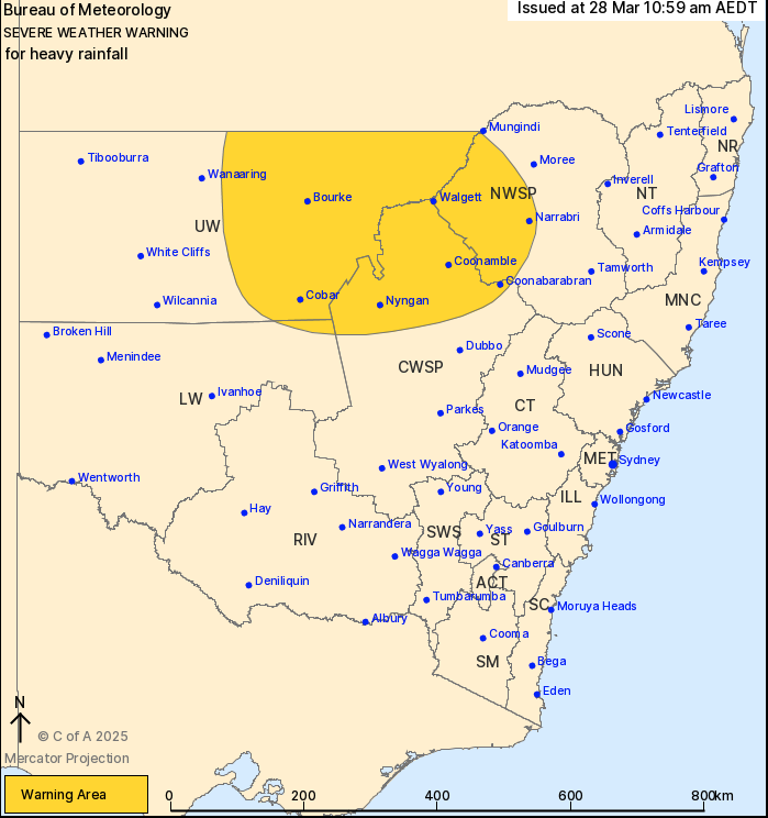
Severe Weather Warning Area. Photo: Bureau of Meteorology.
The heavy rainfall may lead to flash flooding in parts of the Upper Western and extend to the northern reaches of the Central West Slopes and Plains.
The NSW State Emergency Services (SES) advised to monitor conditions for flash flooding in Bourke, Brewarrina, Cobar, Lightning Ridge, and Walgett.
BOM warned sheep graziers of the risk of losing lamb and sheep exposed to the weather conditions.
The SES warned to avoid unnecessary travel, stay indoors, park your car away from trees, powerlines, and drains, secure outdoor furniture, and make sure your emergency kit is on hand in case of a power outage.
The rain is expected to continue throughout the night from Friday to Saturday for most of the Western Plains and slow down or completely stop throughout the day on Saturday.