In for a long haul at Bourke

Danny Hanrahan
16 November 2022, 8:10 PM
 A helicopter filled with medical supplies, bread and other essential supplies departs Bourke airport.
Data released by NSW Water yesterday (16 November 2022) at 6.00am shows the Darling River at Bourke has risen from 13.30 metres on Monday 14 November to 13.62 metres on November 16 and continues rising with major flooding expected to remain for at least a month.
River flows have also increased from 143,214 ML/day on 14 November to 156,541 ML/day on 16 November.
Current predictions are for a peak of 13.9 metres from Wednesday November 20 and the river level may remain above the major flood level (12.70 m) until around mid-December.
Local authorities are well prepared for prolonged flooding and have plans in place to ensure each section of the local community remains connected.
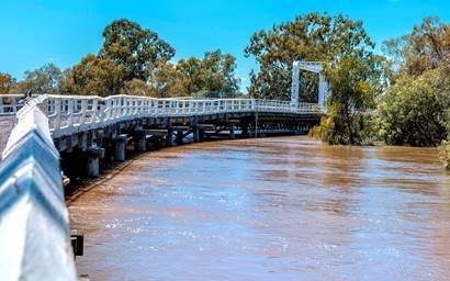
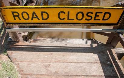
At the old bridge it is clearly visible that the river flow has been increasing.
“Given the current conditions and water height predictions, Bourke Shire Council is monitoring all roads daily," said Bourke General Manager, Leonie Brown.
"Tancred Drive connecting Bourke and North Bourke will remain open. If required a bank will be put in place to retain access”.
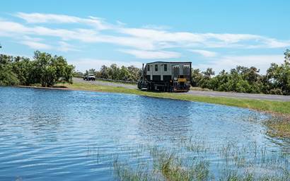
Water at the lowest level on Tacred Drive, Polygonum Swamp 16/11/22
The number of homes and properties being isolated is steadily increasing as water rises outside of the levee surrounding Bourke. Bourke is slowly being encircled by water.
“Bourke has a levee height of 15.1 metres and even in the worst case scenario the water will not reach the levee height. The levee is constantly being monitored and physical patrols are occurring regularly," Ms Brown said.
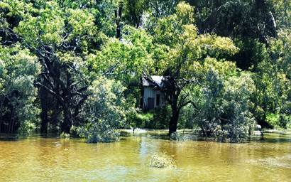
Polygonum Swamp at North Bourke has isolated a number of houses.
Lochmist, between Bourke and North Bourke has resorted to using a boat for transport.
Within the township of Bourke visitors and locals have been flocking to the town wharf to view the mighty Darling River in flood.
A popular way to measure river levels and rate of height increase is to count the number steps leading down to the river.
On Sunday 13 November there were five steps visible and by Wednesday 16 November only two were visible.
There are only two steps visible at the local measuring point.
Bourke Shire Council issued their latest road report on Tuesday 15 November.
Leonie Brown said, “Given the current conditions and water height predictions we are monitoring all roads to provide community updates on Council's webpage and Facebook”.
“The Kidman Way south to Cobar and the Mitchell Highway south towards Nyngan are expected to have water over the road. Once this occurs we will monitor the situation,” Ms Brown said.
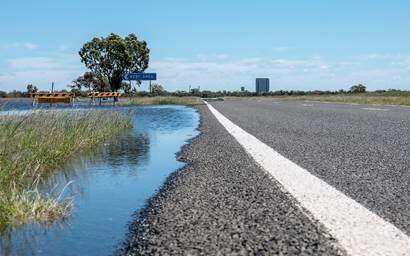
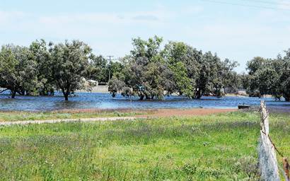
The Kidman Way 3kms south of Bourke. Water will shortly be over the road.
“The Bourke Airport will remain operational during the flood," Ms Brown said.
"We currently have nine helicopters located here. They are being used to ferry supplies to Brewarrina, Walgett and Lightning Ridge.
"The Blackhawk has been ferrying fuel to Lightning Ridge. Now the road has opened to there they have switched to supplying Walgett and Brewarrina with fuel”.