Inland Rail ramps up Narromine to Narrabri

Farren Hotham
29 May 2025, 2:40 AM
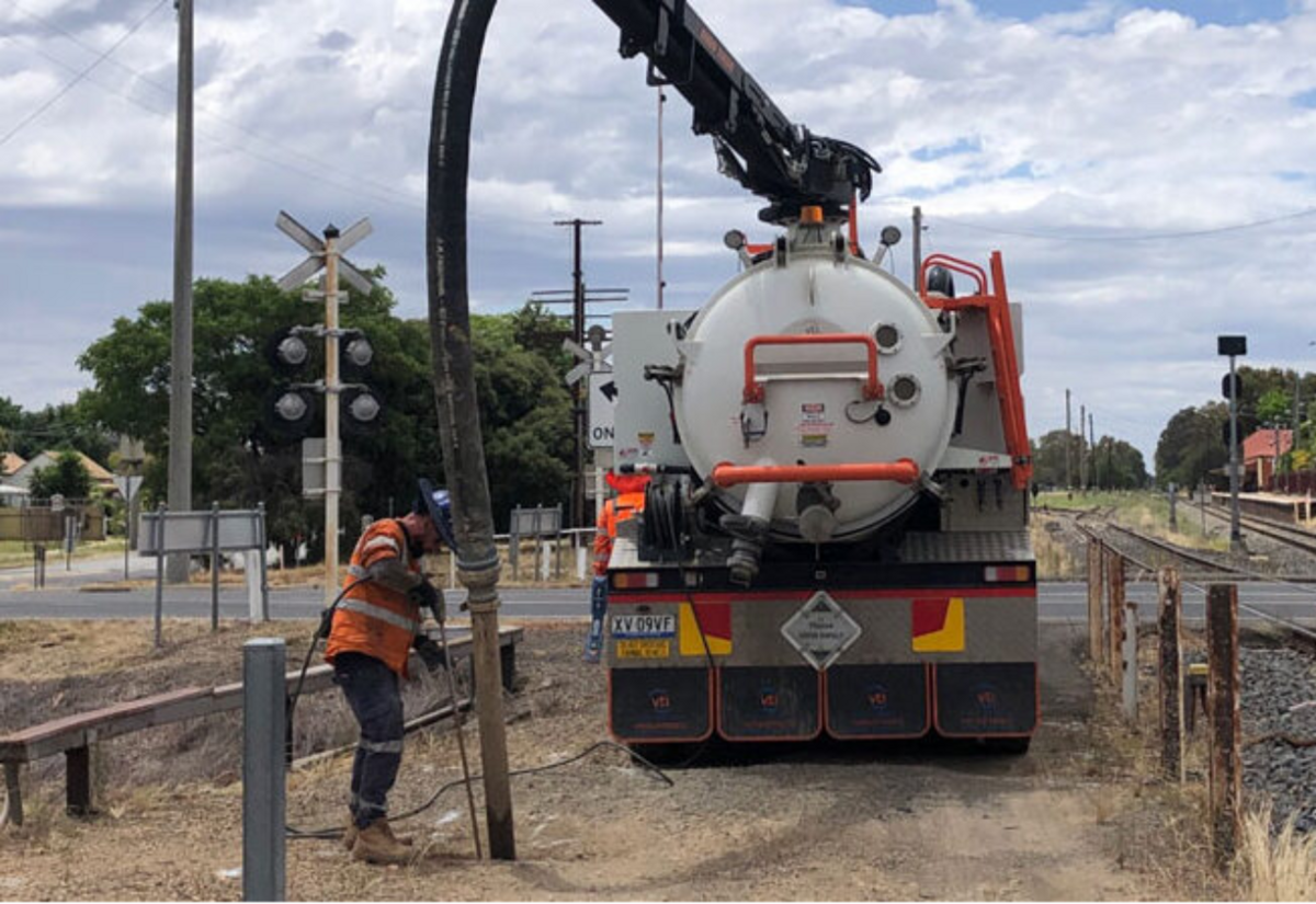 ARTC is using 'non destructive digging' to map underground utilities. IMAGE: ARTC
The Federal Government’s biggest infrastructure project, the Inland Rail, is on track with a 306 kilometre stretch of new build between Narromine and Narrabri awaiting on the results of current work to inform the government's decisions.
The project is powered by the Australian Rail Track Corporation (ARTC), a subsidiary of the Federal Government, and the push to construction on the largest greenfield section was paused after Labor came to power in 2022.
With primary approvals from the NSW Government in 2023 and the Federal Government in January 2024, ARTC has been moving into the detailed design phase.
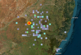
Teams are out in force along the alignment, conducting on the ground research with a particular focus on water in order to refine the track's drainage infrastructure.
The Inland Rail has a projected cost of $31 billion and is designed to ease heavy freight pressure from Melbourne to Brisbane, including a large greenfield section running through Narromine to Narrabri.
‘’Our ongoing schedule of site investigations and surveys along the Narromine to Narrabri section is continuing in 2025 at multiple locations. Soil erosion testing between Narromine and Gilgandra wrapped up in March," a spokesperson said.
"Hydrology specialists are now analysing the samples collected to determine water flow speeds in different locations. This data will inform the design of drainage structures.
‘’We’ve completed geotechnical investigations between Narromine and Coonamble, including 27 boreholes, 65 test pits and 3,745 linear meters of seismic surveys.
"Crews will take a well-earned break and returned in May, subject to gaining land access approvals," they said.
Meanwhile, the borrow pit geotechnical team completed their scope around Gilgandra and are now progressing to sites between Baradine and Narrabri.
In April, locals may have seen biodiversity investigation teams, flood level surveyors and utility investigators in the field.
"Our work is not possible without the continued support and proactive collaboration from alignment landowners. We appreciate and value your commitment to progressing Inland Rail in the central west.’’

IMAGE: ARTC
Greg Peart is a landholder in the Curban area north of Gilgandra, and says teams have been visible on the ground and, behind the scenes, work continues on land acquisition.
"They're ramping up the negotiations south of Curban," Mr Peart said.
He says two or three properties in his neighbourhood have been purchased in their entirety by ARTC while discussions are continuing with other landholders to reach agreement on purchasing land for the main corridor and leasing a wider area for use during the construction period.
"The most important thing is not to end up in compulsory acquisition, you need to be at the table, but I think most landholders are coming on side.
"I have 100 hectares severed off one farm and that's all been surveyed.
"It just depends what the compensation is, they get the agreement and when they pay you is a completely different thing.
"I'd just suggest people get a good compensation lawyer."
June will see the kick off a program of utility investigations in the southern part of the Narrabri to Narromine section.
‘’These investigations identify and map services to prevent damage during future construction and prevent dangerous and costly accidents.
"We will locate water pipes, electric cables, fiber optic cables, gas pipes, drainage and sewage pipelines. Our work will also include confirming the height of all overhead power lines."
Contractor MinStaff Survey will deploy a small crew of field surveyors to collect the data using equipment like a Ground Penetrating Radar or an Electromagnetic Locator to identify depth and position of underground utilities.
Technicians will use hand tools or a vacuum truck to expose below ground utilities by employing high pressure water and suction to remove material and expose services in the ground, particularly sensitive utilities like gas or electric cables.
Wooden stakes will be placed in the ground to identify utility locations, type, depth and direction the utility runs.
Once the field work is completed, the data will inform preliminary designs and help determine if the utility will need to be lowered, protected, removed or relocated.
Further news is expected in June.
By FARREN HOTHAM & LEE O'CONNOR