Memories 'flooding back'? Let Warren Council know!

Kristin Murdock
11 October 2025, 8:40 PM
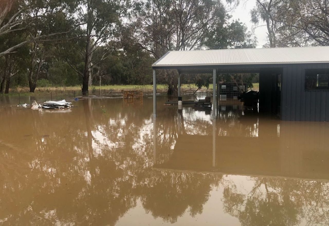 This carport in Warren was flooded in 2022, when the Macquarie River peaked near 9.75 metres. [IMAGES: supplied]
Warren Shire Council is asking residents to share their flood memories, photos and drainage observations to help shape the Warren Flood Study, which is now underway.
The study is being delivered by specialist consultants HydroSpatial Pty Ltd in partnership with Council, as part of the NSW Government’s Floodplain Risk Management Program.
It will combine technical modelling with lived experience to build a clearer picture of how floodwater behaves in and around the town, guiding future planning, funding bids and works.
Warren Shire Mayor Greg Whiteley said many locals have lived through events that maps alone can’t capture.
“We don’t just want data,” he said.
"We want your stories and local knowledge.
“This Flood Study will be stronger and more meaningful if it reflects what people have actually seen and experienced.”
Council’s General Manager, Gary Woodman, said Warren’s levees have protected the community for decades, but they can still be tested during major events.
“That’s why local insights are critical,” he said.
“The community’s photos and observations will validate our models and confirm how floodwaters behave in our town.
"Combining data and experience will help us plan with confidence, seek funding and design infrastructure that makes a real difference.”
While the Warren levies have worked well so far, there is always room for improvement when it comes to flood risk management.
Division Manager (Engineering Services) Sylvester Otieno, who is coordinating the technical work for Council, outlined how community input fits alongside the science.
“Flood studies are the first step towards managing flooding,” he said.
“There are four or five stages, including the Floodplain Risk Management study and plan, and then we go about implementation.”
He said the project uses hydrologic and hydraulic modelling that is then checked against what actually happened on the ground.
“We need to correlate the modelling with real events,” Mr Otieno said.
“People’s experience about where water went, how drains performed, and what roads were cut, helps us confirm the accuracy of the model.”
Residents are encouraged to dig deep into their personal records, with Mr Otieno noting that historical material of any age can help.
“As far back as people can find information,” he said.
Alongside improving preparedness and guiding stormwater and levee rehabilitation, the completed study is expected to assist with fairer insurance outcomes by providing insurers with accurate local
flood data.
Mayor Whiteley said community participation will help build a more resilient Warren.
“Community involvement is essential to the success of this project,” he said.
“Local knowledge of flood behaviour will help guide Council’s planning, improve preparedness and strengthen how we protect Warren into the future.
"I encourage all residents, businesses and property owners to complete the survey or join us at the drop-in session.”
How to have your say
A community drop-in session will be held Tuesday 21 October, 10am–2pm at the Warren Shire Library, for residents to speak with Council staff and share information.
Locals can also complete the Warren Flood Study Survey online or pick up printed copies from Council’s Administration Centre or the Library.
Photos, videos and records can be emailed to [email protected].