Perfect storm expected downstream of Burrendong next week

Abigail McLaughlin
02 October 2022, 6:25 AM
 The Bogan River at Nyngan on Friday 30 September. PHOTO: Dione Carter
Property owners downstream of Gin Gin on the Macquarie River system are preparing for a “perfect storm” next week, with the forecast of significant rainfall combining with an increase in the amount of water being released from Burrendong Dam.
Currently Burrendong Dam is 128.5 percent full and with the Bureau of Meteorology predicting 50mm-75mm widespread rain on Wednesday and Thursday over the catchment, WaterNSW is anxious to bring levels down to a safer level.
The Burrendong Flood Mitigation Zone Reference Panel met on Thursday to discuss the current airspace at the dam, and the likely downstream impacts from the upcoming rainfall event.

Panel member, Richard Woodlock who represents landholders along the Macquarie River creek tributaries down stream of Warren, said there would likely be more flooding as the release rate from Gin Gin increased from the current rate of 30Gl a day to 40Gl a day.
“As creeks are already high, this water may reach the us more quickly than previous releases. Please use this time to move any stock or equipment in low lying areas,” Mr Woodlock told landholders on Saturday.
“Please advise your neighbours if you think they will be impacted by these flows.”
Landholders downstream of Warren have already experienced widespread flooding when water levels surged following the rainfall a fortnight ago.
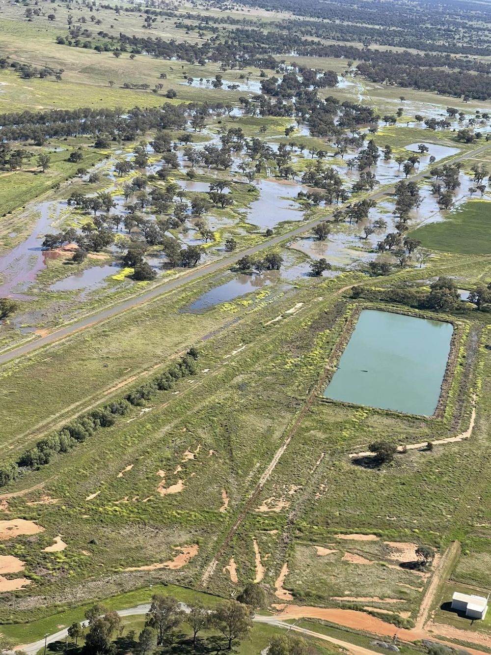
Dione and Jack Carter said around 800 hectares of crop was inundated on their property “Fairview”, north of Nyngan, from the Gunningbar Creek overflow.
Mrs Carter said a flight over their property had shown the real spread of the floodwater, and was busily preparing for the next rise as well as the forecast rain.
“Everything is already saturated and it looks like it’s going to get worse. We are not expecting the crop will come through it. It already turning yellow,” she said.
The Bogan River south of Nyngan along the Tottenham Road on Friday 30 September. Photo courtesy Dione Carter.
The spreading water has also impacted roads in the region, with many closures in the Warren and Bogan Shires where creeks have broken their banks.
Meanwhile the Bogan River peaked in Nyngan town this weekend at a height of 4.2m causing “moderate” flooding.
The SES were visiting properties along Moonagee Road, Temples Lane, Pepper Lane and Bourke Street West over the long weekend to assist with any flood preparations.
In Nyngan, Rotary Park, the Nyngan Golf Course and the Lower Weir precinct were inundated, and there was also flooding at the Riverside Tourist Park and the Bogan Weir Campgrounds.
The Bogan River meets the Macquarie tributaries in the north west of the Bogan Shire on boundary of the Brewarrina Shire.
The BOM is predicting the Bogan River at Mulgawarrina may reach the major flood level (5.50 m) around 9-10 October.


