SES warns communities of flooding at Walgett and Come By Chance

Farren Hotham
19 August 2025, 6:45 AM
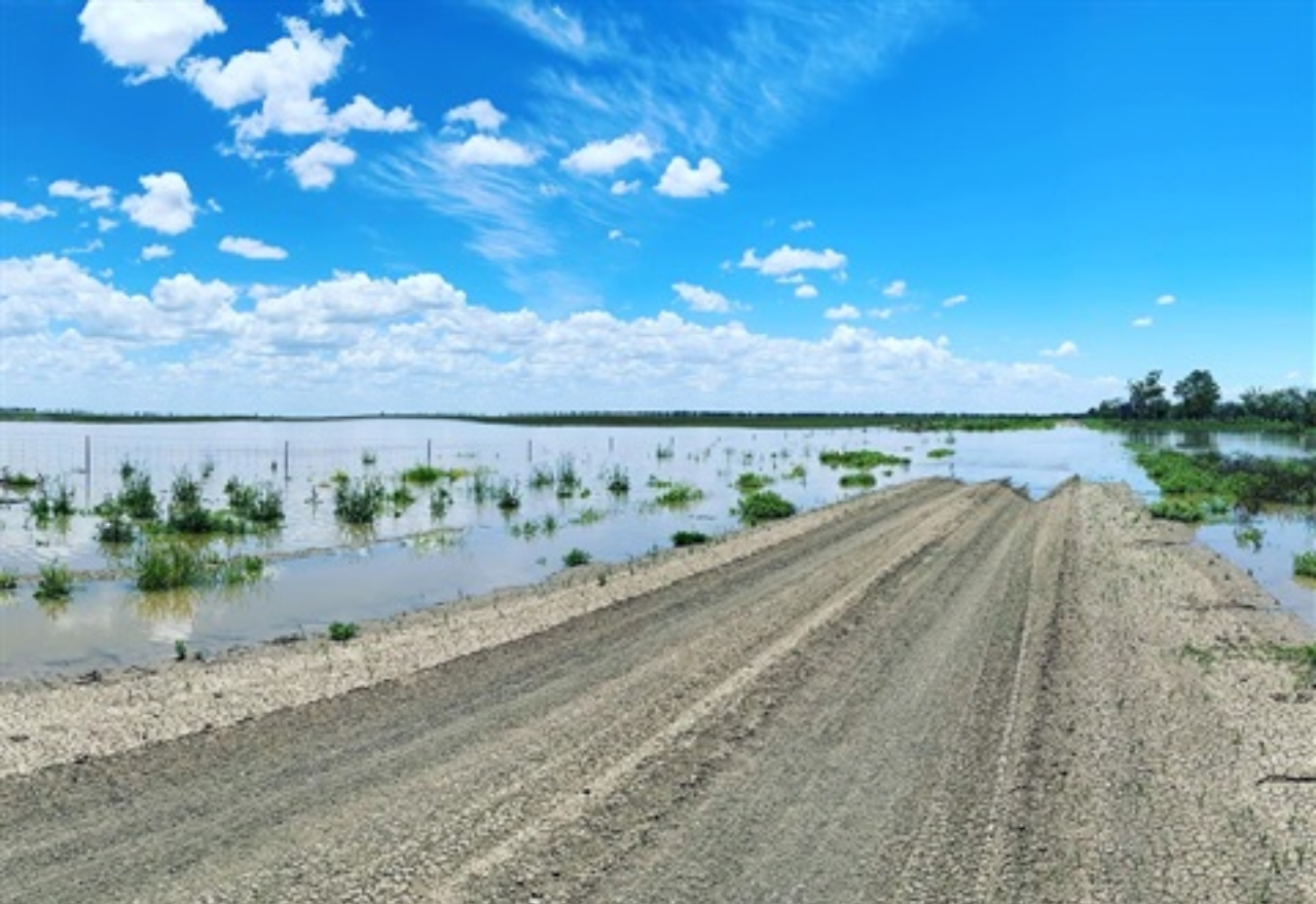 IMAGE: Walgett Shire Council
The NSW Bureau of Metrology and NSW State Emergency Services are warning of expected flooding near Walgett and Come By Chance.
This forecast comes as communities in north western NSW continue to experience flooding caused by a coastal low-pressure system earlier this month.
Flood warnings remain in place for residents of Goangra, Bugilbone, Come By Chance, Walgett and surrounds.
The main flood peak on the Namoi River is near Goangra and will approach the Barwon River at Walgett over the coming days as floodwaters move downstream.
Minor flooding at Walgett is possible from tomorrow (Wednesday 20 August) and the river may peak near 10.80 metres during Thursday, with minor flooding.
Walgett Shire Council has advised that based on predicted rainfall, low lying areas outside the Walgett levee may be impacted by floodwaters:
Local rural roads may close and some rural properties may become isolated.
Assistant Commissioner Malone said with further severe weather on the way, now is not the time to become complacent.
“The NSW SES is prepared to respond to an increase in calls for assistance, but there are simple steps the community can take to be prepared as well,” he said.
Widespread rainfall forecast for northern NSW this week could cause flash flooding and renewed riverine rises, as the NSW State Emergency Service (SES) urges communities to prepare.
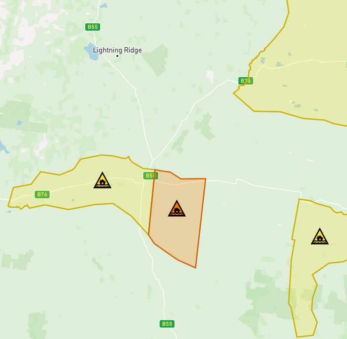
Flood watch warning for Walgett, Goangra and surrounds. [IMAGE: Hazardwatch 4.30pm 19.8.25]
The Bureau of Meteorology is forecasting rainfall to increase across the central and northern coast from Wednesday, with moderate to heavy 24-hour rainfall totals of 40-90mm likely and isolated falls exceeding 120mm possible. In the northwest of the state, rainfall totals of 20-50mm are forecast, with isolated falls exceeding 80mm possible.
While most alerts relate to the north coast region, in the North West Slopes an initial flood watch has been issued for the Peel and Namoi Rivers.
NSW SES Assistant Commissioner Colin Malone said while there was some degree of uncertainty in the location of the heaviest rainfall, they are expecting rivers and creeks to rise.
“We know that catchments in northern NSW are saturated from recent weather events and will respond quickly to this rainfall,” Assistant Commissioner Malone said.
“Thunderstorms could also cause localised heavy falls.
“We’re working closely with the Bureau of Meteorology to monitor the development of this weather system, and we will issue any warnings if required.”
If you need assistance from the NSW SES, call 132 500. In a life-threatening emergency, always call Triple Zero (000).
For local road warnings check Walgett Shire's Road reports.