Storm front crossing western plains
27 January 2022, 4:50 AM
 Thunderstorms are about again this afternoon.
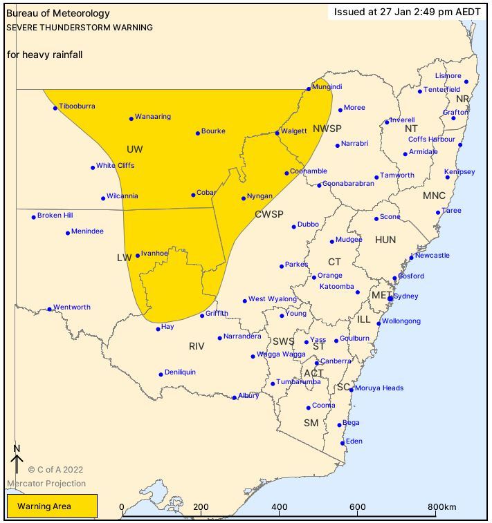
Residents in the Bourke, Cobar, Brewarrina, Walgett, Nyngan, and Lightning Ridge areas are being warned to prepare for storms over the next couple of hours up to about 6pm this evening Thursday 27 January.
The Bureau of Meteorology's Early Warning Network (EWN) has released a alert for people in the Upper Western and parts of the North West Slopes and Central West Slopes and Plains, Riverina and Lower Western Forecast Districts.
Source: ewn.com.au
A warm and humid airmass over the state, together with an approaching upper trough is resulting in severe thunderstorm activity this afternoon with heavy rainfall expected.
Intense rainfall and some localised flooding may result from the slow moving storms.
The State Emergency Services has released their standard warning to avoid creeks and drains and not to enter flood water.
Households should avoid using the phone during the storm and unplug computers and appliances.