Walgett readies for isolation

Laura Williams
16 December 2021, 7:50 PM
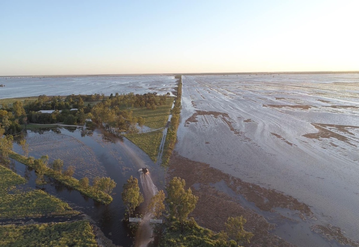 The aerial view of a Walgett property, before the Barwon River has even seen major flood levels. (Image: Lightning Ridge Visitor Centre)
Namoi Village locals, located outside of Walgett, have been urged to evacuate in preparation for the major flood labels expected around Walgett from Friday, December 17.
The low lying village is particularly vulnerable to flood waters, with even the minor flooding that has been seen along the Barwon this week starting to impact the village.
Walgett Shire Council General Manager Michael Urquhart said that they held an emergency community meeting earlier in the week to devise a plan of action.
“I’m not sure how many people are choosing to evacuate, but they will definitely be isolated if they choose to stay,” Mr Urquhart said.
According to the Bureau of Meteorology, it is likely the village’s isolation and inundation of low lying areas will last for approximately 14 days, and throughout the Christmas and New Year period.
As water flows along the Barwon River, Collarenebri is expected to reach moderate flood levels today and throughout the weekend, potentially reaching 8 metres on Saturday, when floodwater may impact low lying streets.
As a result of the rising water levels, the Gwydir Highway has been closed in both directions.
Further along the Barwon, Walgett is expecting to exceed the moderate flood level of 12 metres today, with major flooding expected throughout the weekend, potentially reaching up to 12.5 metres across the next week.
Both the Kamilaroi Highway west of Walgett and the Castlereagh Highway north of Walgett are expected to close this weekend from inundation, blocking access to Lightning Ridge, Collarenebri, Brewarrina and Cumborah.
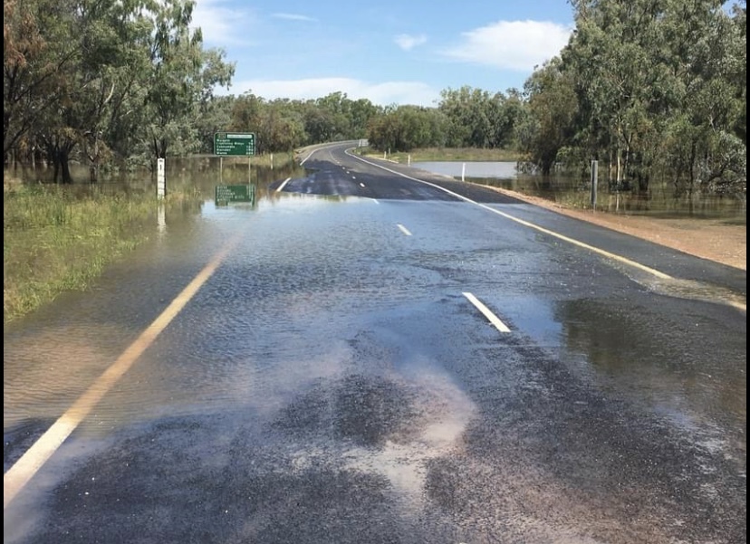
Rising water at the Kamilaroi Highway towards Brewarrina. The SES expects the road to close soon. (Image: Adam Sweeney)
The Castlereagh Highway north of town is expected to remain flooded and closed for at least 14 days, well into the Christmas period.
Mr Urquhart said that the town can expect many more roads to be cut off as the water sets in.
“We will likely be isolated in all directions other than the south towards Coonamble, where we don’t expect to cut off,” he said.
Despite overwhelming amounts of water, the break from rain has allowed some fortunate farmers to continue with their harvest, although like many farmers around the region, there is no way of knowing how long the break from the rain will last.
Lachlan River
Almost 500 kilometres away, Euabalong is experiencing major flooding from the Lachlan River at 6.8 metres. Towards Conodoblin minor flooding is occurring, with the river reaching 5.39 metres.
Both levels are expected to recede over the weekend.
Roads from Euabalong that meet Lake Cargelligo and Condobolin are expected to close from flooding.
With catchments in the area fully saturated, locals in the area have been warned that any heavy downpours could lead to flash flooding, causing dangerous conditions on roads and near watercourses.
Road conditions are subject to change as flooding continues. Locals are urged to check council websites for further details on road closures.