Water juggle at Warren

Audrey Weston
13 August 2022, 3:40 AM
 Residents and travellers need to think and plan ahead to make their way around the Warren district.
With flood water already causing multiple road closures and disruptions to farming operations across the shire and Burrendong Dam sitting at 125 per cent capacity, the current rain event is causing Warren residents and landowners to wonder what’s in store for the town and surrounding district.
For the second time in two months the Macquarie River has reached moderate flood level at the town gauge, with water now encroaching on the golf course and public park as well as local roads and properties.
Mayor Milton Quigley says Warren Shire Council is monitoring the situation closely.
“Given the rain and forecast there is some concern about the volumes currently coming from Burrendong Dam. Ideally we would like to see releases reduced until the tributary flows from this rain event are cleared from the system,” said Cr Quigley.

Along with other councils, landowners and environmental groups, Warren Shire Council is a member of the Burrendong Dam Flood Mitigation Zone Reference Panel which provides advice to Water NSW on the release of water from the flood mitigation zones of the dam.
“Currently releases are targeting 33,000 megs/day at the Gin Gin gauge, which is maintaining the river height as it is. Any more than that will push more water out of the banks and ultimately over both public and private property,” Cr Quigley said.

Warren Shire Mayor Milton Quigley.
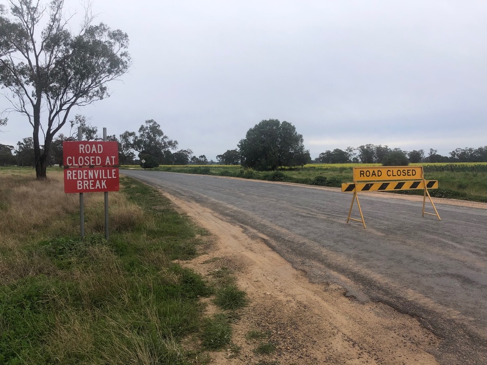
Water is flowing over the Oxley Highway to the north of Warren, with degradation of the road surface requiring traffic lights and one lane traffic only, while a section of the Carinda Road has become so severely compromised it’s had to be closed altogether. To the east the Ellengerah and Wambianna Roads have both been closed for more than a week.
Farming operations have been hit hard, with ongoing delays to cotton harvest in the far east of the shire, many winter crops either waterlogged or not able to be planted at all, and stock having to be moved to high ground or agisted elsewhere.
“It’s a fine balance,” says agronomist Ryan Pratten from Muldoon Pratten Ag Consulting, who has a number of clients in the Warren district. “Government agencies are releasing water out of the dam slowly to avoid a big spill, and this is causing prolonged waterlogging issues for landowners to the north of the shire, but if they reduce those releases too much, and we have a large rain event, we could end up with a major flood.”
Extended road closures in the Warren area are impacting operations of all kinds of businesses.
Landowner David Ramsay, 55 kms from Warren on the Carinda Road has not been able to access part of his property since October last year due to floodwater, with 5000 acres of farming country, usually sown to winter crops, currently under water.
“There’s a huge amount of water at our end of the valley, and water is flowing where I’ve never seen it go before,” said Mr Ramsay. “Flood mitigation is always difficult and it depends where on the river you live or farm as to how you are affected. Here’s hoping we don’t get too much out of this rain event as everything is primed for a major flood.”
By Saturday morning 13 August, 26mm of rain had fallen at Warren town in the previous 24-36 hours with the weather partly cloudy and clearing.

