Where to put planned gauging stations
Laura Williams
03 November 2022, 2:20 AM
 20 new stations are set to be delivered to the northern Murray-Darling Basin. (Supplied)
Stakeholders concerned with the Murray-Darling Basin are being asked to have their say on what locations should be prioritised for five new or upgraded stations in the region.
With 20 gauging stations being installed or upgraded to improve water monitoring within the basin, five locations near Bourke, Walgett, Quambone and Brewarrina have already been determined a priority.
The new gauges will be installed with the aim of improving the water data that’s available in the Darling, Macquarie, Culgoa, Gwydir, Border Rivers, and Namoi catchment.
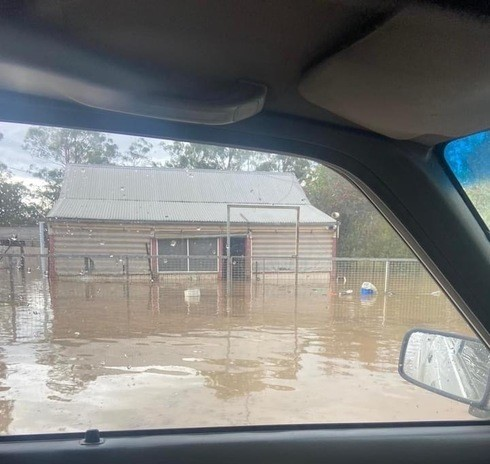
The need for the gauges was made clear when houses in Gwabegar were inundated with water last year after a supercell storm saw more than 230mm enter the Baradine Creek waterway. Without a gauge, there was no way of predicting the disaster that was to strike.
Stakeholders have been invited to participate in an online consultation to determine future priority locations by making a submission, hopefully preventing similar events happening in future.
When announced late last year, NSW Minister for Resources and Water Keith Pitt said that the gauges will help to fill the gaps and deliver better data for farmers, water users and Basin Communities.
“These improved gauges mean we can provide live information on the volume of flows coming down rivers, and the possible impacts these will have on people’s property,” Mr Pitt said.

The inundation at Gwabegar in 2021 came without warning.
The sites will provide varying water information including stream and storage flow and volume, groundwater level, water quality and rainfall data, as well as real-time telemetry.
Information available to the public will include water flows, extractions and water entitlement, and trade information.
The Hydrometric Improvement Plan - undertaken by the Department of Planning and Environment - lists initial prioritisation for new gauging stations, with various locations within the Western Plains making the list.
This includes an upgrade to the gauging station at the Bogan River at Nyngan, replacement gauge installed at the Namoi River between Goangra and Walgett, or a new gauge at Little Bogan upstream of Bourke.
The online consultation will run from 1 November to 31 December 2022.


