Road condition reporting system sparks road rage
Laura Williams
02 April 2022, 9:34 PM
 NSW Farmers is calling on Government to introduce a more effective way of reading the road conditions.
 Outdated, unreliable and unorganised information on local road closures has prompted a major farming body to take their concerns to government, asking for an improved LiveTraffic system that could improve safety.
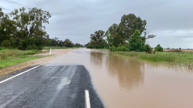
The recent floods in Western NSW that saw roads collapse and towns cut off for weeks at a time were reason enough for locals to constantly need to know the updates with road closures in order to go almost anywhere.
The updates, however, were rarely there for the taking.
NSW Farmers Business, Economics and Trade Committee Chair Bill McDonnell said the event was an unfortunate reminder for the need for a central repository of local road information that councils could easily and directly update in real-time.
“We’re living in a world where we can arrange an overseas holiday at the touch of a button yet finding information on changed local road conditions is not always easy,” Mr McDonnell said.
For locals and truck drivers, being in the dark to current road conditions during floods is just another barrier added to the challenge of thousands of kilometres of dirt roads and poorly maintained sealed roads.
“For the farming sector, having route certainty is important for transporting raw goods and livestock and improves both efficiency and animal welfare outcomes,” Mr McDonnell said.
In some cases motorists take long detours when evacuating areas only to find smaller roads unexpectedly flooded, leaving them with lengthy delays as they try to navigate an uncertain road network.

Floodwaters can rise and cut roads quickly as happened with the Castlereagh Highway in December. PHOTO Brilea Moore.
Mr McDonnell said modern technology enabled sophisticated communication and information access, such as the real-time price reporting on the Fuel Check app, but while LiveTraffic.com was good, there were too many cases of council updates not being fully utilised. NSW Farmers Executive Council last week resolved to take the matter up with the government.
“Consistency is definitely key if we are to achieve certainty for road users, and LiveTraffic.com should become the official go-to source of ‘truth’ to improve certainty and safety, especially in times of crisis,” Mr McDonnell said.
The government, however, doesn’t have a strong track record when it comes to this technology.
The opening of hospitality and retail businesses last year - where proof of Covid-19 vaccination was required - the proposed vaccine passport app was yet to be developed, and was projected to be released almost 10 days after the state’s reopening.
The gap left businesses with an awkward transition period, forcing employees to enforce rules without reliable protocols in place.
Similarly, without sound information for road conditions, safety will come into question.
“It’s particularly important for truckies and motorists to have up-to-date information on regional and rural road closures in events such as flooding and bushfires, where this information can influence potentially life-changing decisions.
The redevelopment of LiveTraffic.comto include a way for councils to contribute their updates , Mr McDonnell said, could be an efficient way of compiling the data.


