"It's unimaginable" - Bourke region flooding

Farren Hotham
26 April 2025, 7:40 AM
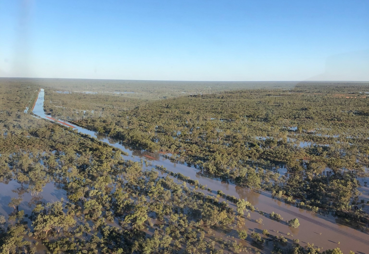 Bourke's council and local landowners are facing massive infrastructure damage. IMAGE BSC
Bourke Shire General Manager Leonie Brown describes this as the worst flood rush in at least 15 years, as fast running water from South West Queensland’s horrific storms flows through her shire's massive road network.
“Theres a lot of work to rebuild and stabilize road formations," she said.
"Eighty kilometres of Hungerford Road is awash and also Wannaring through the Paroo, land holders are being informed and some have never seen this before.’
‘’Council's Roads Team is actively assessing the damage and starting emergency repairs to restore access for landholders and residents affected by the floods.
"The Road network from Enngonia, to Hungerford, Wanaaring, and all areas in between have been impacted."
‘’Low lying areas of Bourke are affected," a spokesperson from the SES said.
"The Bureau of Meteorology advises the Darling River at Bourke is currently at 10.24 metres and rising, above the minor flood level (9.50 m).
"The Darling River at Bourke may peak around 11.20 metres from about Tuesday April 29 to Saturday May 3, with minor flooding.
"This is slightly below the moderate flood level (11.40 m). This prolonged flood peak is expected to extend into the first week of May.
"Based on predictions from the Bureau of Meteorology, the following areas may be impacted by dangerous floodwaters: West Culgoa Road is closed Low-lying roads, bridges and causeways along the river and creeks. Unsealed roads in the area may close.’’
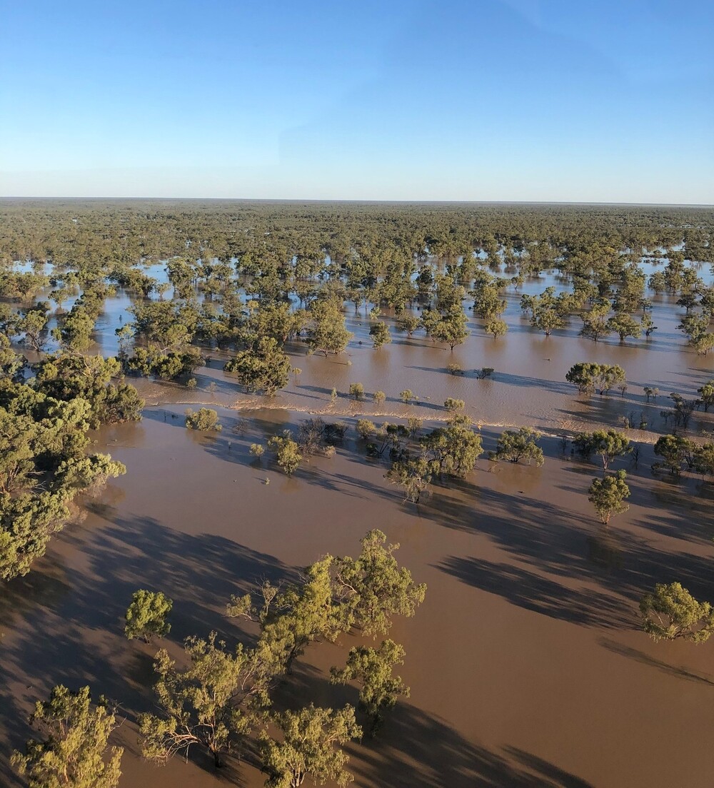
Vast areas surrounding Bourke are underwater. IMAGE: BSC
The General Manager and Mayor say they are working with politicians at all levels.
"NSW Roads Minister Jenny Atchinson has looked at the dire situation," Ms Brown said.
"We couldn’t get a helicopter to get her to see the floods but this is wow..unimaginable.
"It’s the key to feeding Australia and our farmers are locked away so we are doing everything possible.’’
Labor’s Steven Lawrence in Bourke for Anzac Day has said he will help and Nationals candidate for Parkes Jamie Chaffey says if elected he will begin working for the community.
For Brewarrina and surrounding areas there is minor flooding on the Barwon River.
The Bureau of Meteorology advises the Barwon River at Brewarrina is currently at 6.45 metres and falling, above the minor flood level (6.40 m).
The Barwon River at Brewarrina is likely to fall below the minor flood level (6.40 m) over the weekend.
Based on predictions from the Bureau of Meteorology, the following areas may be impacted by dangerous floodwaters: Low-lying roads, bridges and causeways along the river and creeks. Unsealed roads may close.
A spokesperson for Brewarrina Council said the situation was easing though with road access now available to Walgett and Coolabah.